Saint John's Co-Cathedral was commissioned by Grand Master Jean de la Cassière and built as the conventual church for the Knights of Saint John, between 1573 and 1578. It's a Roman Catholic cathedral, dedicated to Saint John the Baptist. The Grand Master and several knights donated gifts of high artistic value for its decoration, making its interior a gem of Baroque art and architecture. While the exterior reflects the knights' military pragmatism, the interior reveals their sophistication, power and wealth. Not to miss the paintings by Caravaggio, "Saint Jerome writing" and "The beheading of Saint John the Baptist". Opening hours: 9.30 to 16.30 (12.30 on Sat., closed on Sun.) Entrance fee: €10 Back to Valletta
The land where the Grote Markt stands was donated to the city in 1220 by Duke Henry I of Brabant. Soon after the first annual markets, also known as the Brabant Fairs, were organised. At the end of the 15th centuryAntwerp became the most prominent city of the Low Countries, with merchants arriving from England, Italy, Spain, Portugal and the Northern German Hanseatic cities. The centrepiece of the square is a large fountain, known as the Brabo Fountain. It was built in 1887 and according to legend, Brabo was a local hero who killed the giant Antigoon and cut off his head and hands. The giant was demanding a high toll to each ship that wanted to enter the city. The square is surrounded by 16th-century Guildhalls, restaurants and cafes. In Winter it hosts the Christmas Market and an ice rink.
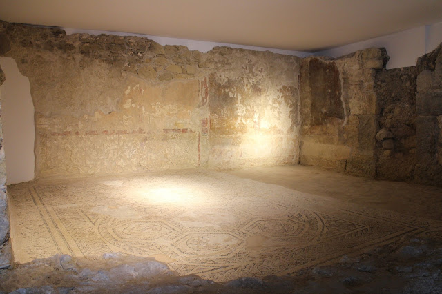
The Hotel Eurostars Museum is located in the old Palace of Coculim, which was built in the 16th century but was mostly destroyed by the 1755 earthquake. Whatever was left after the earthquake was destroyed by the successive uses given to the palace and from its origins only some Mannerist features and the coat of arms of the Counts of Coculim, in the corner, remain. However, the hotel's historical interest has deeper roots, as it is located on top of an area with over 8 thousand years of history, starting in the Neolithic Period. This area has been studied for a few decades and the results are exhibited in the hotel. One of the most important findings was a Phoenician stele because it showed that there were already Phoenician colonies on the Atlantic Coast during the Iron Age and these resulted not only in trading but also in acculturation, as the names on the stele are local names. In one of the exhibition areas are the remains of a Roman domus , including a mos...
Cap de Formentor is the most northeastern point of the Island of Mallorca, where the Tramuntana Mountain range meets the Mediterranean. The 13.5 km winding road that connects Port de Pollença to Cap Formentor is scary and can be crowded at times but the dramatic scenery to be found makes it well worth the drive. On the way to Cap Formentor, there are cliffs 400 metres tall, almost inaccessible beaches with turquoise waters, unusual rock formations and pine woods that guide you halfway to the end of the cape where a lighthouse stands. On the way, there are several viewpoints where it's possible to stop a car for a couple of photos or just to enjoy the scenery. The lighthouse was inaugurated in 1863 and at the time it was only accessible by sea or by a mule track. This isolation came to an end in the 1930s when the asphalted road was built and today there's a shop and a restaurant for a well deserved light meal after the thrills and scares of getting there. ...



Comments
Post a Comment